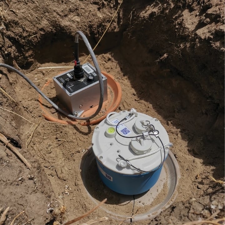
Introduction Karst terrains, characterised by soluble rock such as limestone, present significant geohazards for urban development, infrastructure projects, and groundwater management. In rapidly growing...
Advanced seismic monitoring to uncover the mysteries of tectonic activity in a high-seismicity region.
Advancing seismic research to mitigate earthquake hazards through SmartSolo technology.
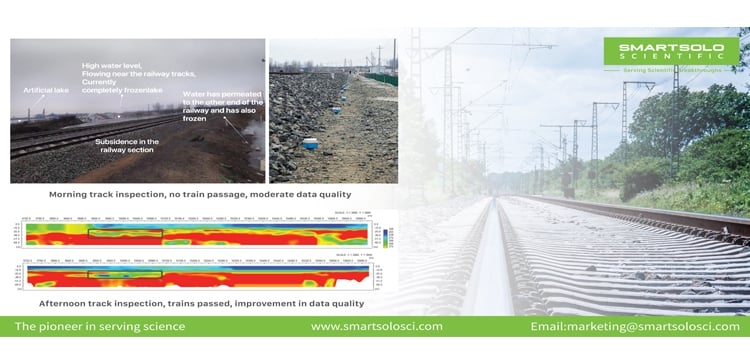
Comprehensive geological analysis to ensure the safety and stability of critical railway infrastructure.
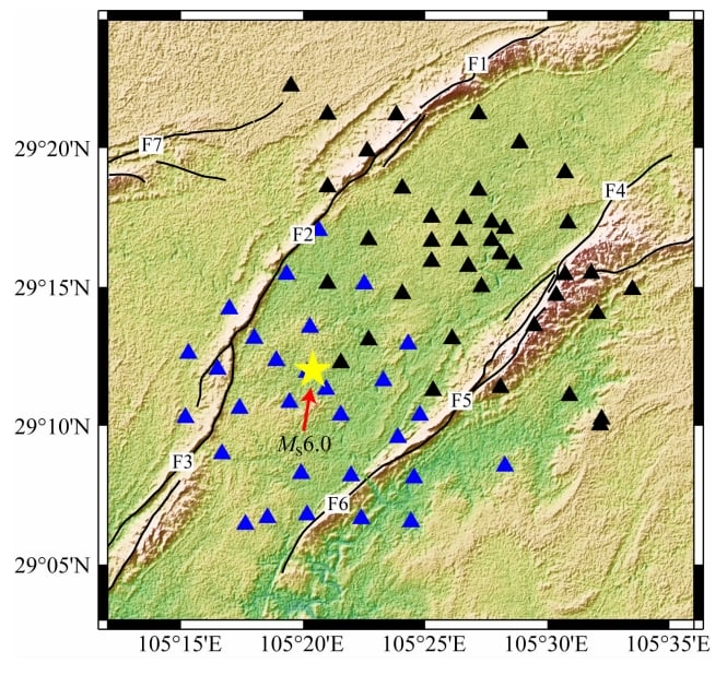
Using SmartSolo technology for efficient aftershock monitoring and improved earthquake hazard understanding in Western...

SmartSolo and NodalSeismic lead the way in geophysical exploration for carbon capture.
Efficient, non-invasive microseismic monitoring for safer and smarter mining operations.
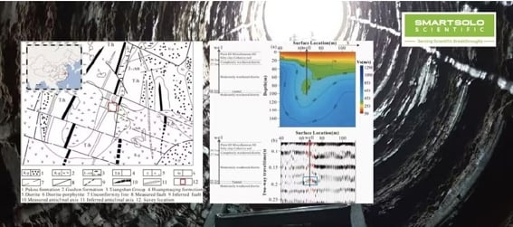
Mapping underground structures with advanced seismic imaging techniques and SmartSolo technology.
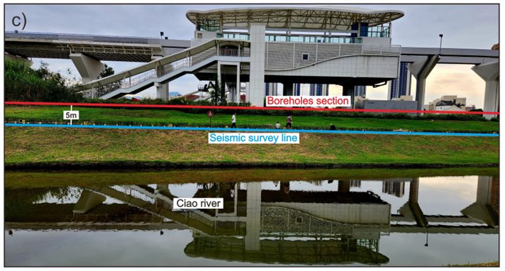
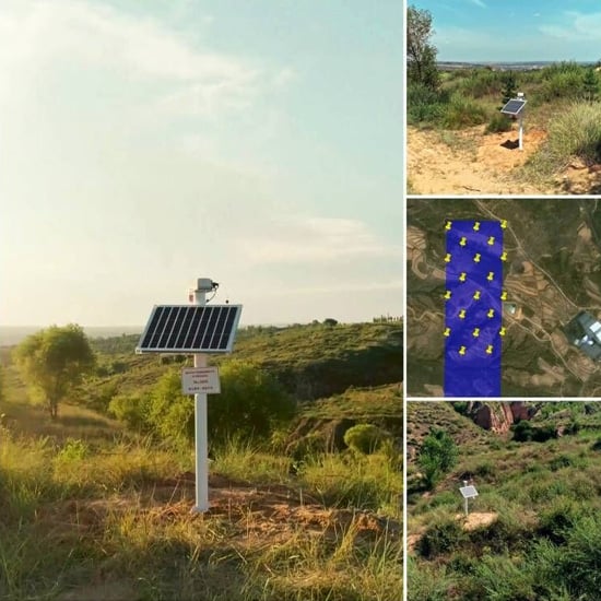
Exploring the potential of dense seismic arrays for urban fault surveys, employing innovative and cutting-edge methodologies...
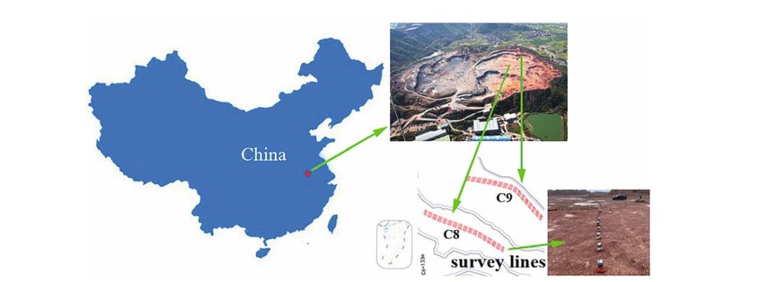
Introduction Karst terrains, characterised by soluble rock such as limestone, present significant geohazards for...
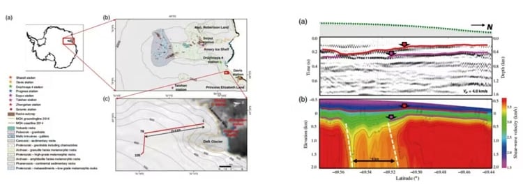
Introduction This case study showcases a pioneering application of passive seismic technology to advance “geological...