Research Overview
To ensure the safety and stability of the Sichuan-Tibet Railway’s Tongmai-Lulang section, a research team employed background noise tomography to analyze the shallow geological structures along the route. The primary objectives of the study include:
- Characterizing Fault Geometries: Determining the shapes and configurations of faults.
- Assessing Fault Activity: Understanding the dynamics of fault activity in the region.
- Geological Risk Assessment: Evaluating potential geological hazards that could impact railway operations.
Using short-period dense array waveform data, the team constructed a high-resolution S-wave fine velocity structure of the shallow surface, combining this data with geological surveys to deliver precise insights.
Equipment and Deployment
Equipment Details
- Model: SmartSolo IGU-16HR EB 3C short-period seismometers.
- Bandwidth: 0.2~150.0 Hz.
- Quantity: 78 units.
Deployment Configuration
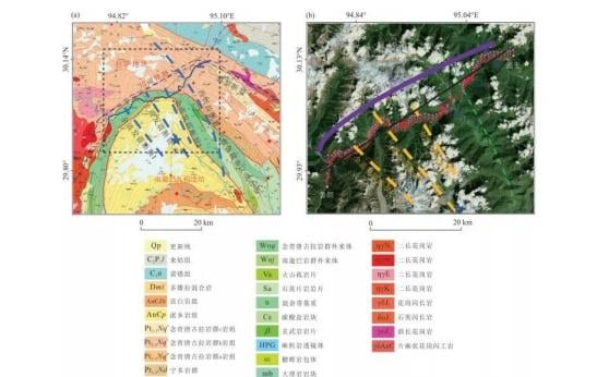
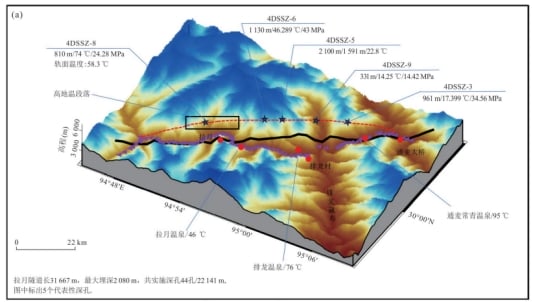
- Location: Along National Highway 318, south of the Layue Tunnel.
- Spacing Between Stations: 500 meters.
- Total Length of Stations: 40 kilometers.
- Monitoring Duration: 40 days (April 2021).
Data Collection
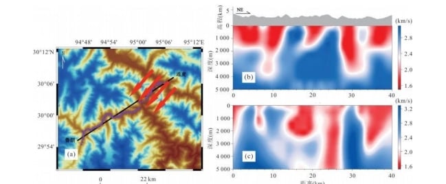
- Z-component waveform data from 37 days was selected.
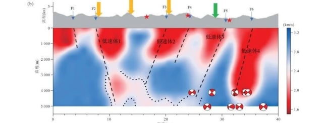
- Background noise cross-correlation methods were used to generate layered S-wave velocity structure profiles along the railway route.
Key Findings
- The study accurately determined the geometry and activity characteristics of faults along the railway route.
- The results provide crucial data for understanding the shallow geological structures, enabling a comprehensive evaluation of potential risks to railway infrastructure.
- High-resolution S-wave velocity imaging highlights areas of concern, aiding in disaster prevention and mitigation efforts.
Significance
This research represents a critical step in enhancing the safety and reliability of the Sichuan-Tibet Railway. By leveraging advanced seismic imaging techniques and SmartSolo IGU-16HR EB 3C seismometers, the study delivers actionable insights into geological hazards, paving the way for safer and more efficient railway operations in one of the world’s most geologically complex regions.