
Understanding the Salazie Cirque
The Salazie cirque, located on Réunion Island, is one of the world’s finest examples of a volcanic cirque. This unique geological formation is home to exceptional phenomena that are of significant scientific interest. One of the most dramatic events in this region was the Salazie landslide, which caused substantial damage to houses and infrastructure in an inhabited area.
For over 20 years, the BRGM division on Réunion Island has been monitoring large-scale landslides within the Salazie cirque. Their ongoing efforts aim to better understand these geological events and mitigate associated risks.
Leveraging Seismic Data for Insights
To gain a clearer picture of the subsurface and understand the causes behind a major landslide in the Salazie cirque, BRGM scientists are employing advanced seismic imaging techniques. The process involves:
- Controlled Source Seismic Waves: Seismic waves are generated by detonating explosives at a depth of approximately 2 meters.
- Deployment of Seismic Sensors: Around 100 seismic sensors will be installed in a line spanning over 2 kilometers. These sensors will record and measure the vibrations caused by the controlled source.
Data Acquisition and Analysis
The recorded seismic data will allow scientists to visualize the geological structures beneath the landslide area. This detailed imaging will help:
- Assess the role of water in triggering the landslide.
- Understand the mechanics of the land slippage.
The data will be meticulously analyzed over several months to create an accurate image of the deep subsurface.
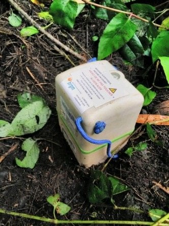
The Role of SmartSolo
SmartSolo seismic sensors play a crucial role in this project by providing reliable and precise measurements of subsurface vibrations. Their advanced technology ensures efficient and accurate data acquisition, making them an indispensable tool for such complex geological investigations.
Aiming for Better Landslide Management
Once the subsurface imaging is complete, BRGM scientists aim to:
- Fully understand the factors contributing to the Salazie landslide.
- Develop improved strategies to manage and mitigate destructive landslide risks in the future.
This project demonstrates the importance of cutting-edge technology like SmartSolo in advancing our understanding of natural disasters and protecting vulnerable communities.