Tapping Geothermal Potential in France’s Roannais Basin
The global push towards sustainable energy sources has intensified the search for reliable, clean power. Geothermal energy, harnessing the Earth’s natural heat, represents a significant opportunity. In France, the Roannais Agglomeration is embarking on an ambitious project to explore its geothermal potential, leveraging advanced geophysical exploration techniques. This initiative aligns with the region’s commitment to becoming a Positive Energy Territory (TEPOS), aiming to reduce energy consumption and boost renewable energy production.
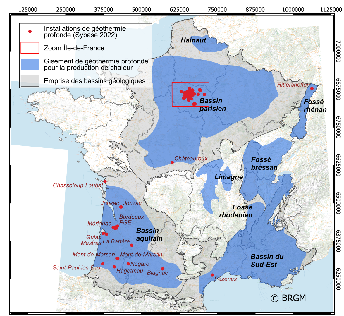
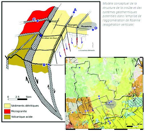
Understanding the subsurface geology is paramount for successful geothermal exploitation. The Roannais Basin holds promise due to specific geological characteristics. Studies indicate potentially high heat flows at relatively shallow depths. The basement rock, primarily granitic, is largely impermeable but features significant fault systems. These faults can act as conduits for geothermal fluids. Notably, a major fault axis runs between Sail-les-Bains and Saint-Alban-les-Eaux, with other intersecting faults creating zones of particular interest for geothermal resources. The presence of “Tufs Anthracifère” also suggests potential for associated resources like lithium and rare earth elements.
To validate and map this potential, a detailed seismic survey program is essential. SmartSolo, a leader in serving geoscience, including seismic acquisition technology, recognizes the critical role precise subsurface imaging plays in such pioneering projects.
A Deep Dive with Advanced Geophysics at Phase 3
The Roannais geothermal project is structured in phases. Phase 3, scheduled from January 2025 to the end of 2025, focuses intensely on geophysical qualification of the subsurface. This phase is crucial for building a robust geological model and de-risking future development.
The primary objectives of this geophysical campaign are comprehensive:
- Determine Subsurface Structure: Characterize rock types, their depths, and thicknesses.
- Identify and Locate Faults: Map the subterranean fault network accurately.
- Define Fault Geometry: Understand the shape and size of faults in three dimensions.
- Detect Fluid Circulation: Identify pathways where geothermal fluids might be moving within the fault systems.
To achieve these goals, a multi-method approach will be employed, integrating data from various techniques:
- 3-Component Passive Seismic Surveys: Utilizing natural ambient noise to image the subsurface.
- Gravimetric Measurements: Detecting density variations related to different rock types and structures.
- Magnetotelluric Soundings: Measuring electrical resistivity to understand rock properties and fluid content.
- Soil CO2 Emanation Measurements: Assessing natural gas seepage, which can be linked to fault activity and geothermal systems.
Each method provides unique insights, and their combination allows for a more complete and reliable interpretation of the complex geology beneath the Roannais Basin.
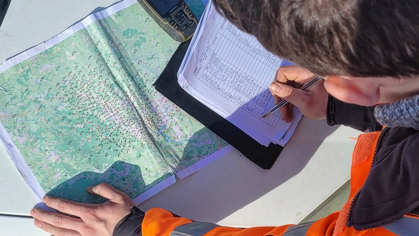
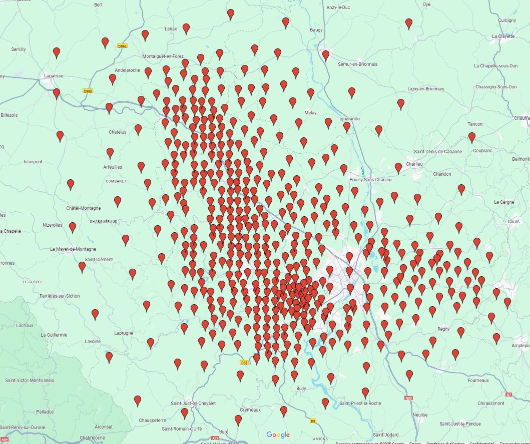
In the Roanne agglomeration community, nearly 500 sensors spaced from 400 meters to 5 kilometers cover an area of approximately 2,000 km². The objective is to obtain an image of the subsurface down to a depth of about 5 kilometers, which is an interesting depth for considering deep geothermal energy.
The Power of Passive Seismic Exploration
Among the planned techniques, passive seismic exploration plays a pivotal role, particularly the use of 3-component data acquisition. Unlike active seismic surveys that use artificial sources (like vibrator trucks or explosives), passive seismic methods listen to the Earth’s natural ambient noise. This noise comes from various sources, including ocean waves, wind, industrial activity, and traffic.
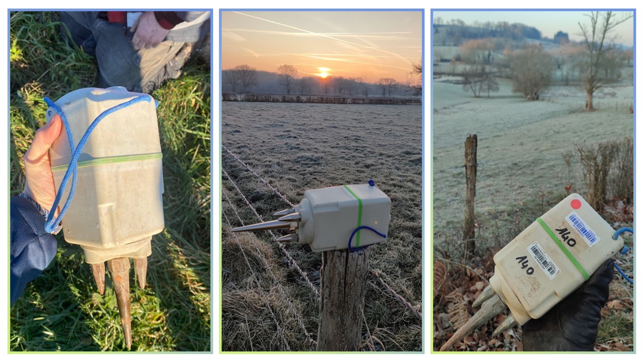
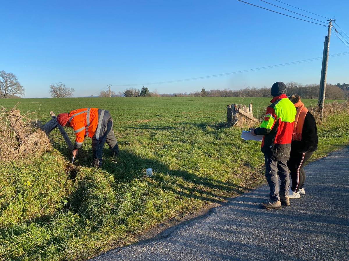
By deploying a network of sensitive seismic sensors – advanced geophones or seismometers – geophysicists can record these faint ground vibrations over extended periods. Sophisticated processing techniques, such as ambient noise interferometry, analyze the correlations between recordings at different sensor locations. This allows scientists to reconstruct how seismic waves travel through the subsurface, revealing variations in velocity that correspond to different geological layers, structures, and fault zones.
Why Passive Seismic is Ideal for Roannais
Passive seismic methods offer several advantages for a project like the one in the Roannais Basin:
- Deep Imaging: Ambient noise often contains lower frequencies than typical active sources, enabling imaging of deeper structures relevant for geothermal exploration.
- Fault Characterization: The technique is particularly effective at identifying and mapping fault zones, which are critical targets for geothermal fluids. Previous SmartSolo projects have demonstrated success in using passive seismic data to precisely locate and analyze fault zones.
- Environmental Sensitivity: Passive surveys are non-invasive and have minimal environmental impact compared to active source methods, making them suitable for deployment in various settings.
- Cost-Effectiveness: For long-term monitoring or large-area reconnaissance, passive seismic can be highly cost-effective.
The requirement for 3-component data acquisition adds significant value. While single-component sensors measure vertical ground motion, 3-component sensors capture motion in three dimensions (vertical, north-south, east-west). This provides a much richer dataset, allowing for the analysis of both compressional (P) waves and shear (S) waves, leading to more detailed velocity models and a better understanding of rock properties and potential fluid content.
SmartSolo Technology: Precision and Reliability for Passive Surveys
Executing a successful passive seismic exploration campaign, especially one requiring high-fidelity 3-component data over a potentially large area, demands advanced instrumentation. This is where SmartSolo technology provides significant advantages. Projects like the Roannais Basin initiative benefit immensely from the capabilities inherent in SmartSolo seismic nodes.
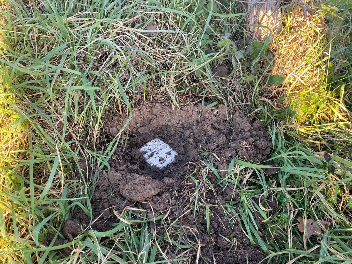
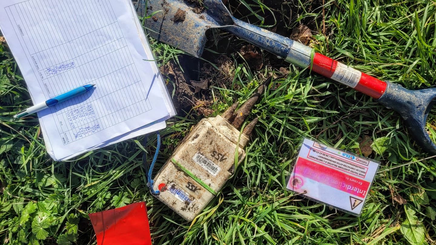
SmartSolo designs and manufactures state-of-the-art nodal seismometers, such as the IGU-16 series, which are ideally suited for the challenges of modern geophysical exploration, including passive seismic surveys.
Key Features Enabling Success
- High Sensitivity: SmartSolo nodes are engineered with low instrument noise floors, crucial for detecting the faint signals characteristic of ambient seismic noise. This ensures high-quality data capture, essential for accurate subsurface imaging.
- 3-Component Capability: SmartSolo offers highly accurate 3-component nodes (like the IGU-16HR 3C) that precisely capture the full seismic wavefield, fulfilling the requirements outlined for the Roannais project.
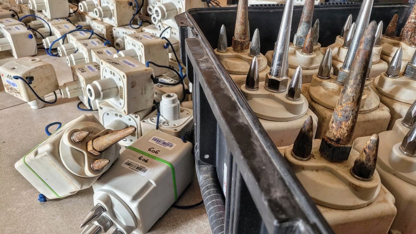
- Lightweight and Portable: The compact and lightweight design of SmartSolo nodes simplifies deployment and retrieval, especially in challenging terrain or areas with limited access. This improves operational efficiency and reduces field effort.
- Ruggedness and Reliability: Field conditions can be harsh. SmartSolo nodes are built to withstand extreme temperatures, moisture, and physical impacts, ensuring continuous, reliable data acquisition throughout the survey period. Rigorous testing, including being run over by heavy trucks, confirms their durability.
- High-Density Deployment: The affordability and ease of use of SmartSolo nodes enable cost-effective, high-density deployments. Larger numbers of sensors provide better spatial sampling, leading to higher-resolution imaging of complex structures like fault networks. SmartSolo has supported numerous large-scale 3D projects.
- Operational Efficiency: Features like long battery life and efficient data handling streamline field operations, contributing to project timelines and budgets. The SEG environmental noise survey saw 64 nodes deployed in just 3 hours.
SmartSolo technology has a proven track record in passive seismic applications. For instance, a project using 200 SmartSolo nodes successfully employed ambient noise imaging to pinpoint fault zones. Another study by the SEG utilized SmartSolo nodes for characterizing ambient seismic noise, extending the usable frequency range and improving velocity modeling. These examples underscore the suitability of SmartSolo equipment for the demanding requirements of the Roannais Basin seismic survey.
Expected Outcomes and the Path Forward
The passive seismic exploration component of Phase 3 is expected to yield critical data for the Roannais geothermal project. By integrating the 3-component passive seismic results with data from gravity, magnetotellurics, and CO2 measurements, geoscientists aim to build a detailed 3D model of the subsurface.
This model will highlight:
- The precise location, depth, and geometry of major fault systems.
- Variations in rock properties indicative of potential geothermal reservoirs.
- Possible zones of enhanced permeability and fluid circulation within faults.
These insights are fundamental for identifying optimal locations for potential future drilling and assessing the overall feasibility and scale of geothermal energy development in the region. The findings from Phase 3, concluding at the end of 2025, will feed into a crucial report guiding the subsequent stages of the project, potentially leading towards exploitation in Phase 4 (planned for early 2027 to early 2029).
Your Partner in Advanced Geophysical Exploration
The Roannais Basin geothermal project exemplifies the increasing reliance on sophisticated geophysical exploration techniques to unlock renewable energy resources. Passive seismic surveys, powered by advanced nodal technology, are at the forefront of this endeavor.
SmartSolo provides robust, reliable, and high-performance seismic nodes required for such demanding applications. Our commitment extends beyond hardware; we offer comprehensive support, including 24/7 customer service and a global network of service centers, ensuring project success across various industries like oil and gas, geothermal, civil engineering, environmental research, and mining.
By choosing SmartSolo, exploration teams gain access to:
- Cutting-edge nodal seismometer technology.
- Proven reliability in diverse and challenging environments.
- Cost-effective solutions for high-density surveys.
- Unparalleled data quality for confident interpretations.
- Dedicated global support.
Illuminating the Subsurface for a Sustainable Future
The exploration efforts in the Roannais Basin represent a significant step towards harnessing local, clean energy resources. The success of this project hinges on accurately characterizing the subsurface geology, a task for which advanced passive seismic exploration is indispensable. The use of sensitive 3-component geophones deployed in dense networks will provide unprecedented detail about the fault systems and structures holding geothermal potential.
SmartSolo is proud to offer the technology that enables such critical earth science investigations. Our advanced seismic nodes empower geophysicists to conduct detailed seismic surveys with greater efficiency and confidence. As the world transitions towards sustainable energy, SmartSolo remains committed to providing the tools needed to explore and understand the Earth’s resources, contributing to projects like the Roannais Basin initiative and paving the way for a cleaner energy future.